Human Influence Index
Citation Information
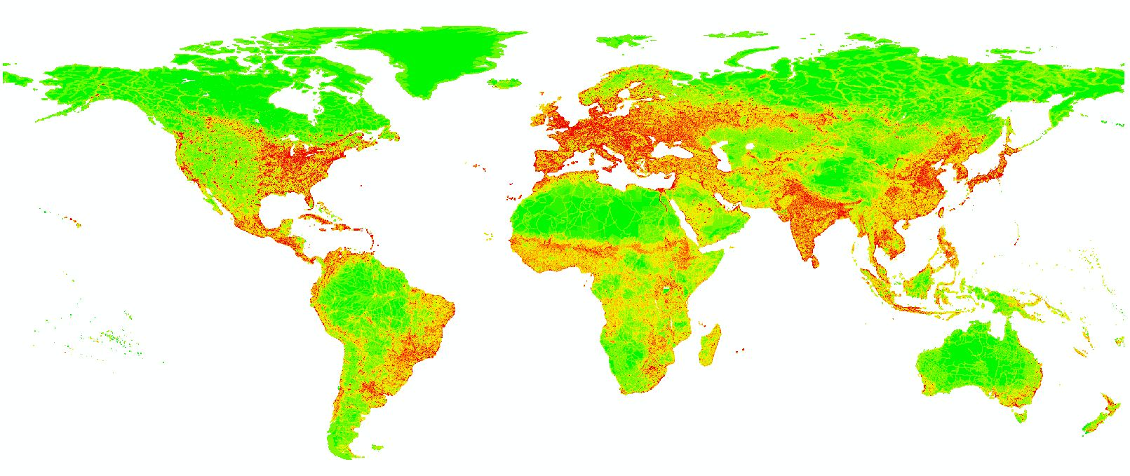
Title: Human Influence Index
Source: Wildlife Conservation Society (WCS), Center for International Earth Science Information Network (CIESIN), Columbia University
Date: 2005
Citation: Wildlife Conservation Society (WCS); Center for International Earth Science Information Network (CIESIN), Columbia University. 2005. Last of the Wild Project, Version 2, 2005 (LWP-2): Global Human Influence Index (HII) Dataset (Geographic). Palisades, NY: NASA Socioeconomic Data and Applications Center (SEDAC). http://sedac.ciesin.columbia.edu/data/set/wildareas-v2-human-influence-index-geographic. Accessed 31, December, 2012.
Description
An updated map of anthropogenic impacts on the environment created from nine global data layers covering human population pressure (population density), human land use and infrastructure (built-up areas, nighttime lights, land use/land cover), and human access (coastlines, roads, railroads, navigable rivers). Native resolution is 30 arc second projected in Geographic Coordinate System WGS 1984.
Processing Procedure
1. In ArcMap 10.0, use zonal statistics to calculate mean values within each GLU.
Data Coverage
Data is coded by the number of cells covered by the native data (1), data extrapolation (2), and not covered by either (3).
| DGG Cell Coverage Reports | |||||
| Coverage Codes | Frequency | Percent | Valid Percent | Cumulative Percent | |
| Valid | 1 | 1368115 | 94.7 | 94.7 | 94.7 |
| 2 | 70633 | 4.9 | 4.9 | 99.6 | |
| 3 | 6216 | .4 | .4 | 100.0 | |
| Total | 1444964 | 100.0 | 100.0 | ||